|
|
As air streams over mountain ranges lee waves (vertical oscillations) are set up down wind. Under the right conditions clouds form on the crests of the lee waves.
|
|
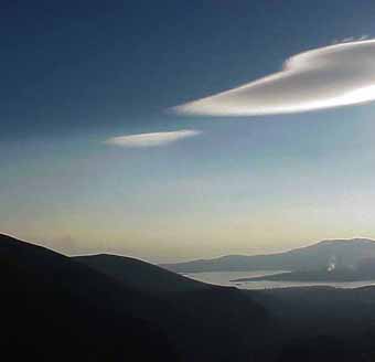
The very fine example at right is a small part of an unusually narrow, long, well formed lee-wave cloud from Hawke Bay New Zealand. It was photographed by Nikolai Joyce.
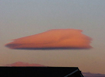
This second example of lee wave clouds was photographed at sunset in Blenheim NZ, on the 24/6/04. Lee wave clouds and isolated lenticular clouds are present.
Typical lenticular clouds form as wind layers are swept upwards over hills or mountains, cooling moist air to below the dew point. The clouds are stationary; forming on the leading edge and evaporating as the wind descends and the air warms.
|
Ch Ch, NZ: Photo: Jacobs |
Lenticular clouds can be single as in the example above or stacked. On some occasions the stacks can be somewhat complex.
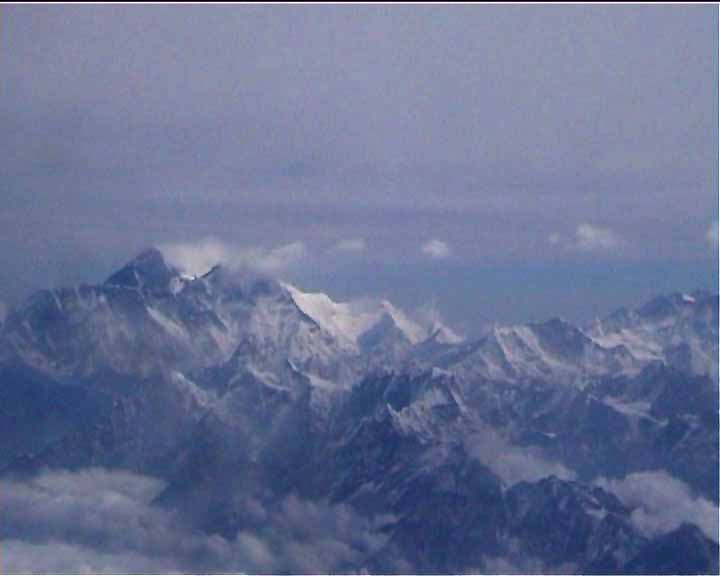
On some occasions a line of evenly spaced lenticulars forms in the lee wave of a mountain. The line below is down-wind of a well known peak on the border between Nepal and Tibet.
|
Sagamartha
Photo: Jacobs |
1 Short-lived lenticular clouds are often seen in Bangkok as cumulonimbus clouds rise through wind layers. They are easily distinguished from the more common pileus [skull cap] clouds. The image at right shows cap clouds and a lenticular stack above a rising cumulus at sunset. The stack is down-wind from the cap-cloud. The formation appeared suddenly and lasted for 30 seconds. It decayed as the cumulus rose through the wind layers. The photograph was taken at sunset in Bangkok with a digital MAVICA DF91 with 12x optical zoom.
2 A lenticular stack is shown above a large anvil cloud at sunset. The structure of the lenticulars is clear but the photograph is disappointing. The brilliant iridescent colors; green, mauve yellow and red, have not been well reproduced. The three lenticular clouds appeared suddenly and persisted for ten minutes.
3 Small lenticular clouds are often scattered among cumulus clouds in the Bangkok skies. Sometimes small lenticulars appear to be isolated like 'flying saucers', as in this example, taken at sunset.
4 January 4, 2006 was a calm fine day in Bangkok with an unusually active sky. Large diffuse lenticular clouds formed at about 1000 meters in the late morning.
The sequence at right is particualrly interesting. It begins with the sudden appearence a small cumulus cloud followed by a lenticular above, and then, as a lenticular stack develops over the first cloud a second tiny cloud appears with its own lenticular. The photographs were taken at 45 second intervals. Small cumulus couds form under the crests of lee waves behind mountain ranges are called rotor clouds. The sequence here is remarkable because it shows both a nenticular sequence and rotor clouds on an apparntly calm day with no land mass involved in their formation.
 www - Delphi. Photo:
Jacobs
www - Delphi. Photo:
Jacobs